


What to Know So Far About the New C5 Roads along Taguig
Your daily commute may just get a tad easier (and faster), especially to those residing in Taguig and nearby areas.
The Department of Public Works and Highways (DPWH) has two on-going road constructions along Taguig: the C5 South Link and the C5 Expressway.
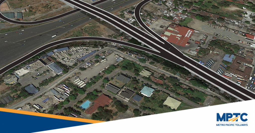
C5 South Link
The C5 South Link is a 7.7-kilometer toll road that will span CP Garcia, Taguig to Sucat, Parañaque, connecting Cavitex via Merville and Sucat. According to DPWH Secretary Mark Villar, the 2.2-kilometer segment of the road is targeted to open to the public by July 23.
Said segment, known as Segment 3A1, features the bridge that crosses over Skyway at-grade and SLEX.
This will decongest Sales Road, as well as the East and West Service roads, enabling motorists to cross from Parañaque to Taguig (and vice versa) faster.
 The C5 South Link spans Taguig to Sucat, Parañaque
“Vehicular traffic spends about 1.5hours just to cross from Villamor to Taguig via Fort Bonifacio. This section alone will help about 5,000 vehicles easily cross in under 3 minutes,” said Villar in a press release. He also added that the targeted toll fee for Segment 3A1 is between Php 20 to Php 22.
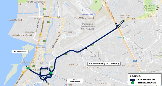 Map of the C5 South Link
Bobby Bontia, President and General Manager of Cavitex Infrastructure Corporation (CIC), also stated that an estimated 50,000 cars in key areas in Metro Manila will greatly benefit once the C5 South Link is finished. These include Makati, Taguig, Las Piñas, Pasay and Parañaque, even EDSA.
The C5 South Link, a Php10-billion project awarded by the DPWH to CIC, was originally scheduled to be completed by 2022, but is now set to be finished by the fourth quarter of 2021—all due to the efforts of DPWH to fast-track its construction.
C5 Expressway
DPWH is also constructing a 20-kilometer elevated expressway that will span from the end of NLEX Segment 8.2 in Quezon City to C5 South Link in Taguig called the C5 Expressway.
Once the expressway is complete, motorists can seamlessly travel from North to South, and vice versa. This will also reduce the two-hour travel time via C5 road to just 15 minutes even at rush hours.
Lastly, the expressway will serve as an alternative to reach Metro Manila’s business districts, airports, major educational institutions, and residential areas.
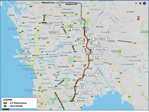 Map of C5 Expressway
The C5 Expressway is part of the C5 Circumferential Expressway alignment that is a crucial component of the Metro Manila Urban Expressway Network.
Also Read: Expats’ Guide to Expressways in the Philippines
Sources: Metro Pacific Tollways, Cavitex, DPWH
Images grabbed from Metro Pacific Tollways and DPWH


