


Cloudy skies with rain, two tropical depressions, and cold weather: Primer Weather forecast
It’s going to be a fairly wet day today as the country is experiencing the effects of an intertropical convergence zone (ITCZ) and the Northeast monsoon, commonly referred to as amihan.
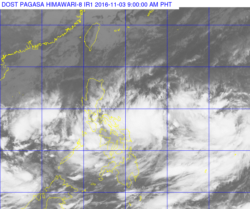
RAINY DAY. Two tropical storms, an ITCZ, and the Northeast monsoon combine to give the Philippines a wet November 5.
The ITCZ currently affecting Bicol Region, CALABARZON, MIMAROPA, Visayas, and Mindanao will bring cloudy skies with light to moderate rains and thunderstorms. Metro Manila and the rest of Luzon will experience cloudy skies with light rains due to the effects of the Northeast monsoon, expected to persist until February.
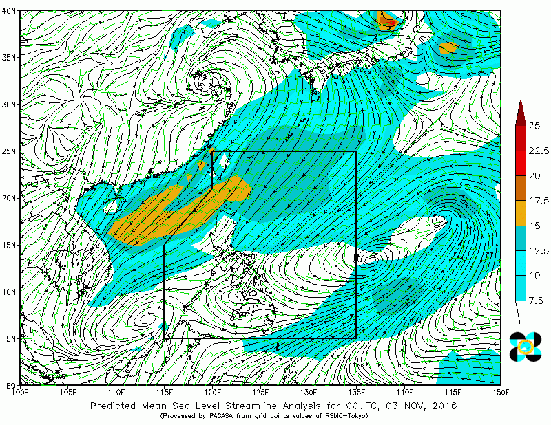 ROUGH SEAS. Take extra care if you’re going to be out along the northern and eastern seabords.
Expect moderate to rough seas along the Eastern and Northern seaboard as moderate to strong winds blowing from the northeast and north will prevail over Luzon and Eastern Visayas. Light to moderate winds will prevail elsewhere giving other areas a chance to fish.
Two tropical depressions are also being monitored by the Philippine Atmospheric, Geophysical and Astronomical Services Administration, both bringing maximum sustained winds of 55 kilometers per hour and gustiness of 70 kilometers per hour.
One tropical depression was spotted 2,400 kilometers east of Luzon, while the other one has since been upgraded by the Japan Meteorological Agency (JMA) to a tropical storm with the international name “Meari”. Meari is tagged as almost stationary by the JMA, and will be called “Marce” once it enters the Philippine Area of Responsibility (PAR) within the day.
Source: PAGASA website, ABS-CBN News, GMA News Online, Japan Meteorological Agency
All photos grabbed from PAGASA


