


TY Karen exits as TY Lawin enters PAR; may reach supertyphoon status
The country may still be reeling from the effects of Typhoon Karen, but there’s no rest for the weary as another typhoon is set to enter the Philippine Area of Responsibility (PAR).
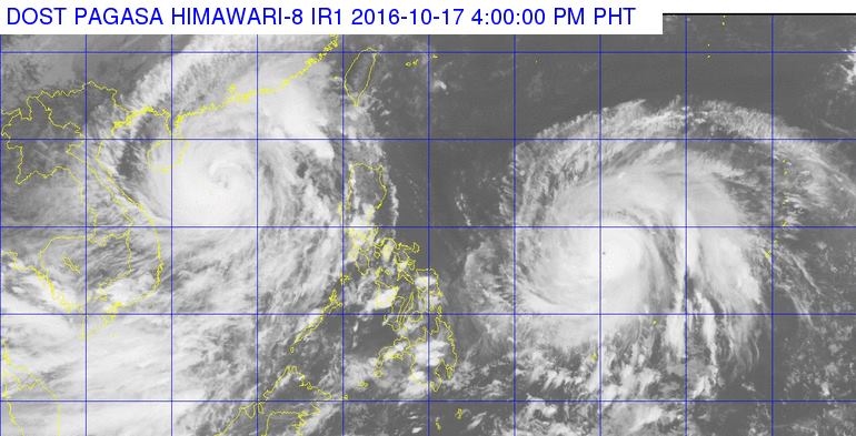
GOODBYE, KAREN; HELLO, LAWIN. Typhoon Karen left the PAR yesterday as Typhoon Haima is set to enter the PAR tomorrow. It will be called Lawin once it enters the PAR.
A typhoon with the international name Haima will enter PAR tomorrow afternoon. It packs winds of up to 175 kilometers per hour (kph) near the center with gusts reaching as high as 215kph. Once it enters the PAR tomorrow, it will be called Lawin.
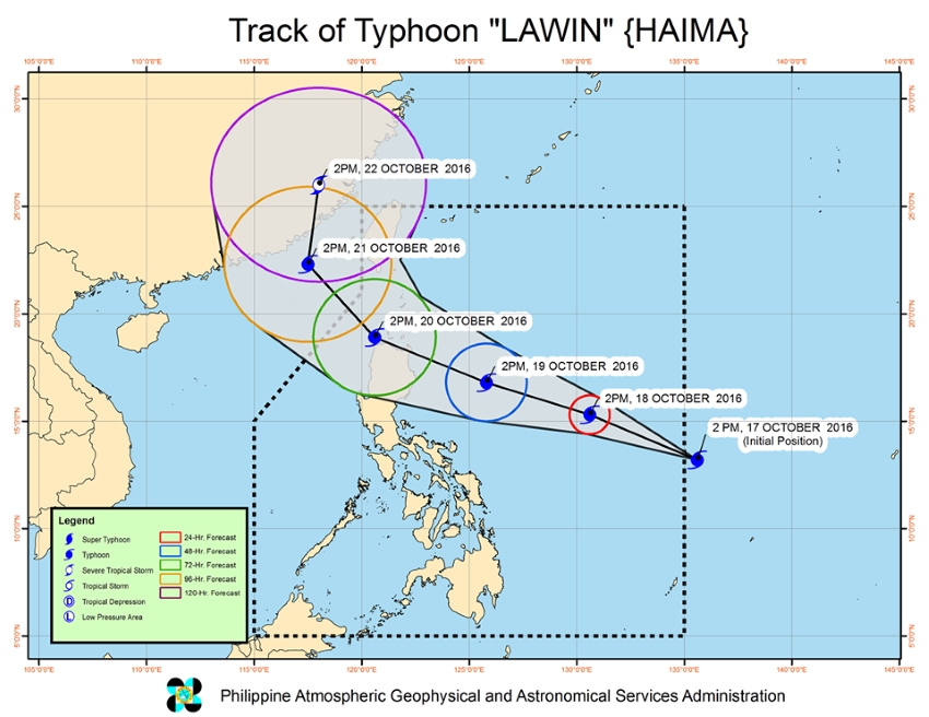
GONE BY FRIDAY. If Typhoon Lawin stays the course, it should be out of the country by Friday.
Forecasts indicate that Lawin is expected to move West Northwest at a speed of 24kph. It will be spending a significant amount of time over water before it hits land on Wednesday or Thursday. If it continues on its current track and speed, it should be out of the PAR by Friday afternoon.
No tropical cyclone warning signals have been issued as of today.
All images grabbed from Dost_pagasa Facebook page
Source: Dost_pagasa Facebook page, Rappler, Inquirer.net, CNN Philippines, InterAksyon.com, Philstar.com


